
|
| You might also like: | Geography Wheels | Label the Compass Directions in English Printout | GEOGRAPHY | Today's featured page: Explorers from the 1800s |
| Our subscribers' grade-level estimate for this page: 3rd - 4th |
 Outline Maps |
EnchantedLearning.com World Geography |
 Flags |
| Africa | Antarctica | Asia | Australia/Oceania | Central America/ Caribbean | Europe | Mideast | North America | South America | USA |
| A | B | C | D | E | F | G | H | I | J | K | L | M | N | O | P | Q | R | S | T | U | V | W | X | Y | Z |
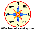
 Compass Directions in English A Label Me! Printout Label the compass directions in English. Answers |
Compass Directions in French A Label Me! Printout Label the compass directions in French. Answers |
Compass Directions in German A Label Me! Printout Label the compass directions in German. Answers |
Compass Directions in Italian A Label Me! Printout Label the compass directions in Italian. Answers |
Compass Directions in Spanish A Label Me! Printout Label the compass directions in Spanish. Answers |
 Compass Rose Printout A compass rose is a design on a map that shows direction. Fill in the directions on this compass rose printout. |
 Continental Drift See how and why the continents are slowly changing their position and shape. |
Continents and Oceans Quiz Print out this quiz and learn about the 5 oceans and 7 continents on Earth. |
 Continents: Label the Map Label the continents, the poles, and the equator. |
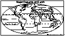 Deserts of the World Label the major deserts of the world. Answers |
The Earth Learn about our planet, its make-up and its place in the Solar System. |
 Explorers Read about people who explored our planet and beyond. |
Geography Crafts and Activities These are crafts that help you learn geography. |
 Geography: Label Me! - Printouts Print out and label many maps of Continents, oceans, US states, and Canadian provinces. |
Geography Words in English and Spanish Geography-related words in English and Spanish (in picture dictionary format). |
 Glossary of Landforms Learn terms describing land and water forms on Earth. |
 Landforms Quiz: Grades 2-3 A word scavenger hunt for students in Grades 2-3, using the Little Explorers Picture Dictionary. |
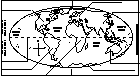
 Latitude and Longitude Label Me Printout Label the latitudes and longitudes on the world map. Answers |
   Map Projections A projection is a representation of one thing onto another, such as a curved 3-Dimensional surface (like the Earth) onto a flat 2-Dimensional map. A projection is a representation of one thing onto another, such as a curved 3-Dimensional surface (like the Earth) onto a flat 2-Dimensional map. There are 3 major types of projections, cylindrical, conic, and planar |
 Map Reading Activity Printout Color the map, read compass directions, estimate distance, and read latitude and longitude. Answers |
 Map Reading Activity Printout: Topographic Maps #1 Color the elevations of the topographic map, then answer questions about the map. Answers |
 Map Reading Activity Printout: Topographic Maps #2 Color the elevations of the topographic map, interpret the map and answer questions. Answers |
 Oceans Maps, animals, science, activities and other information on oceans. |
Ocean Map: Label the Oceans Label the Arctic, Atlantic, Indian and Pacific Oceans. Answers |
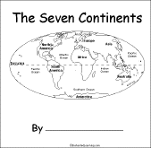 The Seven Continents A short activity book on the continents to print for early readers. There are pages on each of the seven continents. |
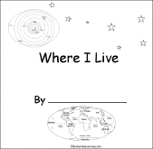 Where I Live (USA and Canada) A short activity book on geography to print for early readers. There are pages on the Solar System, the continents, North America, and Canada or the USA. |
 World Flags A page on the flags of many countries. |
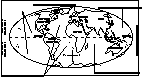
 World Map Label Me Printout Label the continents, oceans, poles, equator, and prime meridian. Answers |
Little Explorers Picture Dictionary:
-English
-English-French
-English-German
-English-Italian
-English-Japanese
-English-Portuguese
-English-Spanish
Enchanted Learning®
Over 35,000 Web Pages
Sample Pages for Prospective Subscribers, or click below
|
Overview of Site What's New Enchanted Learning Home Monthly Activity Calendar Books to Print Site Index K-3 Crafts K-3 Themes Little Explorers Picture dictionary PreK/K Activities Rebus Rhymes Stories Writing Cloze Activities Essay Topics Newspaper Writing Activities Parts of Speech Fiction The Test of Time
|
Biology Animal Printouts Biology Label Printouts Biomes Birds Butterflies Dinosaurs Food Chain Human Anatomy Mammals Plants Rainforests Sharks Whales Physical Sciences: K-12 Astronomy The Earth Geology Hurricanes Landforms Oceans Tsunami Volcano |
Languages Dutch French German Italian Japanese (Romaji) Portuguese Spanish Swedish Geography/History Explorers Flags Geography Inventors US History Other Topics Art and Artists Calendars College Finder Crafts Graphic Organizers Label Me! Printouts Math Music Word Wheels |
Click to read our Privacy Policy
| Search the Enchanted Learning website for: |
Copyright ©2002-2018 EnchantedLearning.com ------ How to cite a web page